VIEW NH SNOWMOBILE TRAIL MAP
The online version of NH Snowmobile Trail Map is completely free to use. Plan your trips, save itineraries for future adventures or share them with friends.
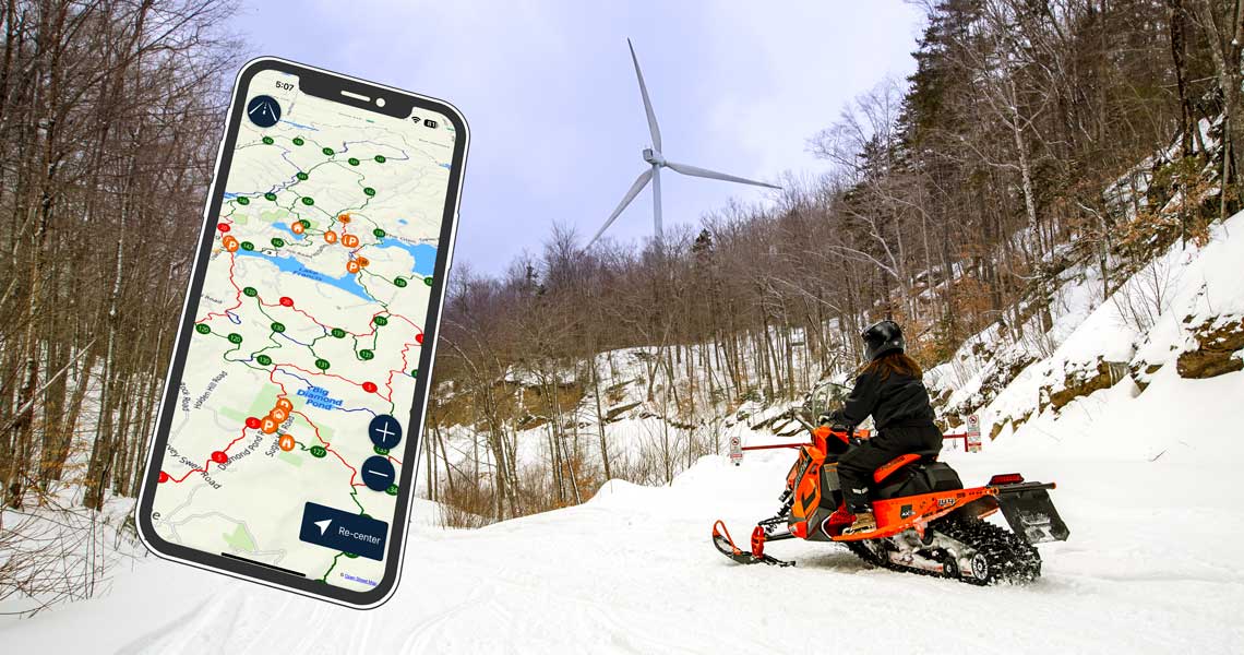
Download NH Trail Map for iPhone and Android
SledNH Snowmobile Trail Map App is available for iPhone at the Apple App Store or Android at the Google Play Store.
Download the app, select a starting point and destination, then ride!
Made By Snowmobilers For Snowmobilers. In partnership with local clubs of the association and the NH Bureau of Trails, the SledNH map is the most up-to-date map of NH snowmobile trails.
New Hampshire Snowmobile Map App Features
- Cell Service Not Required for Navigation
- No cell service needed to pinpoint your exact location and load routes
- 7,000 miles of NH snowmobile club trails in the palm of your hand
- Select a starting point and destination, then go!
- Plan trips in advance and save them for future adventures
- Easily modify destinations on the go, with drag and drop menu
- $4.99 per season for the mobile app
- Get the App Now! iPhone, iPad or Android
NH Snowmobile Map for Garmin GPS
The official SledNH routable snowmobile trail map for Garmin GPS units. Download now!
Advertise on the Map
Direct snowmobilers to your businesses, get discovered, get on the map!
Need Help? NH Snowmobile Trail Map FAQ
Read General App Questions and Instructions.
Note: we only offer the Pro Version, without subscription!
Are paper maps available?
While the NHSA does not offer paper maps many clubs sell paper versions of their local trails. Check club websites for availability.
How To Mount Phone to Snowmobile and Manage Battery Life.
Easy Snowmobile Phone Mount Makes Trail Map Highly Visible
Inexpensive Snowmobile Phone Mount with Wireless Charging
I bought the app last season. Does it expire?
The app is valid for the season in which it is bought. Next season you can purchase the new version to access the up-to-date trail map. Club volunteers maintain the trails and map information, without them riding would be impossible. Show your support!
You must be logged in to post a comment.